Illustrated maps show you where to go and why to get there
The heyday of mapmakers may be over (sorry, cartography majors!), but people will always need visual cues to help them navigate unfamiliar territory.
We are all, at this point, handy enough with Google Maps or a floor plan to get us where we need to be… but what if, on the way from A to B, we’re missing out on splendor, excitement, or even vital information?
Or what if you’re put in charge of welcoming people to someplace they’ve never been, and you’ve a lot of information that might be of value to the traveler?
What if… what if we added illustrations?
Illustrated maps can convey much more information than simply where one is and where one might go: They also impart what’s nearby, where important resources can be found, and even who the map was designed for.
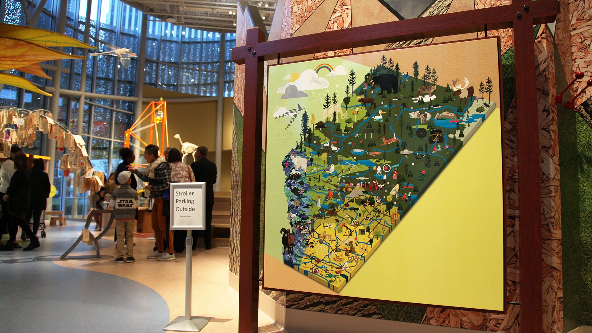
For instance, the illustrated map Curio created for the Royal Alberta Museum packs a TON of information that would interest a scholar of our province: Flora. Fauna. Arts. Attractions. Rivers. Roadways. Mountains. Mastodons. Tiny Ants. Giant pierogies.
There are exactly zero words on this map, but you could spend almost as much time taking in all the info as we did drawing it (just kidding, you absolutely could not).
On the street level
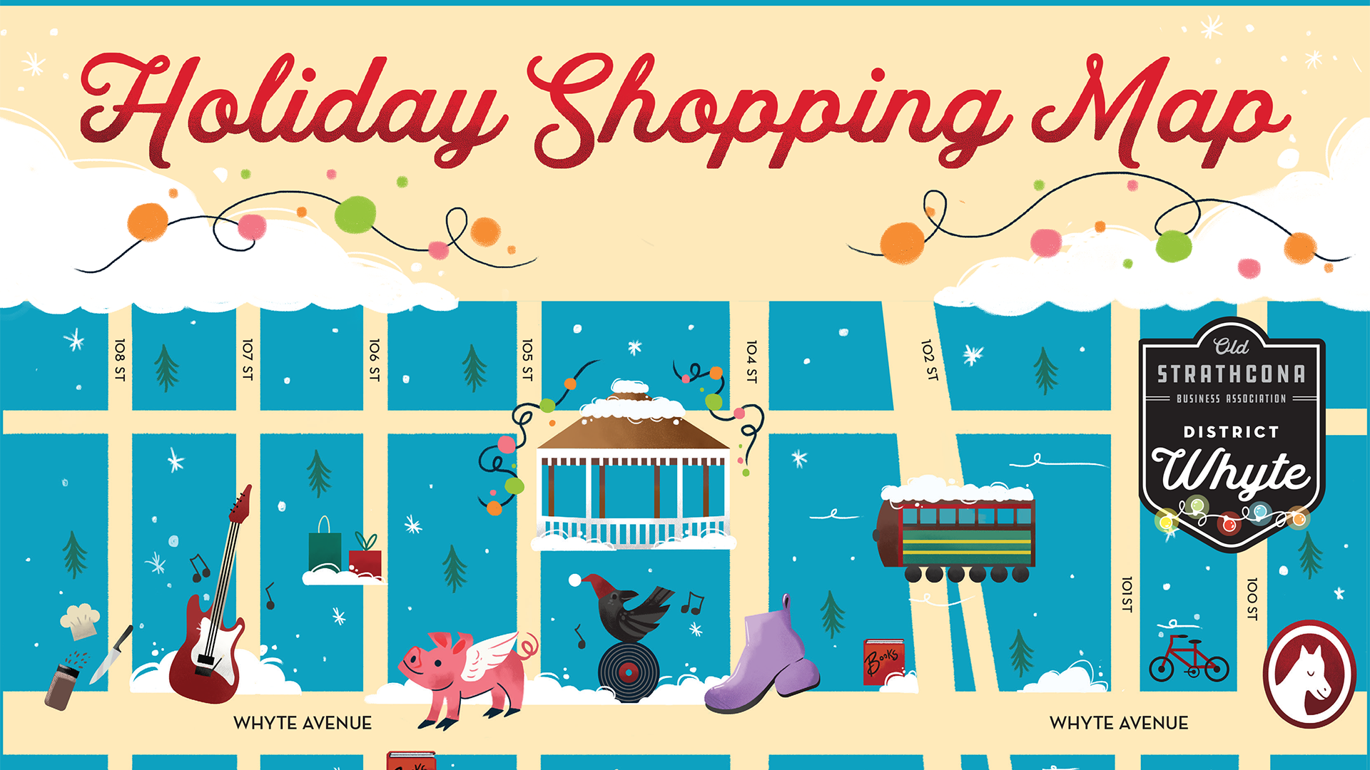
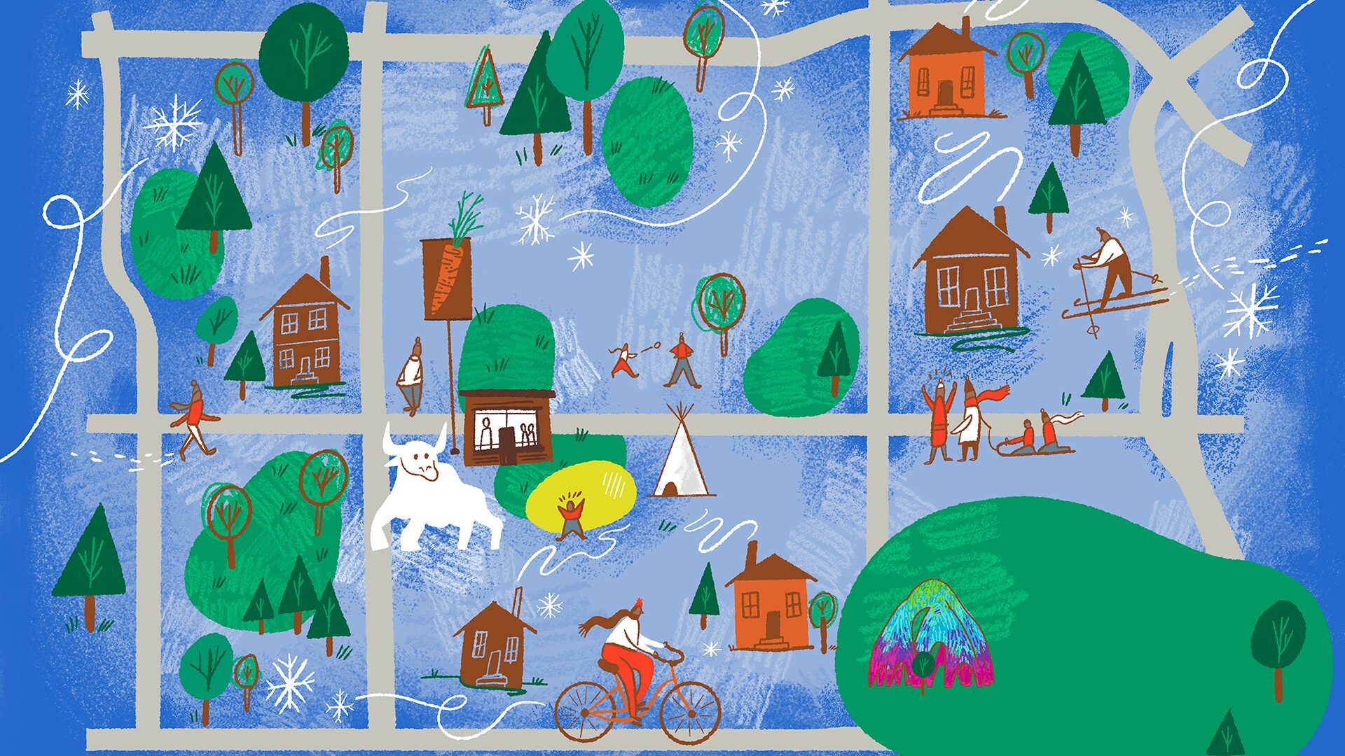
Illustrated maps like the ones we’ve created for the Old Strathcona Business Association or the Deep Freeze Festival allow locals and visitors alike to navigate by attractions and activities—an opportunity to immerse oneself in local specialties and to truly explore the space.
And when the location itself is what’s being marketed, a bit of extra visual zhuzh can help newcomers imagine themselves at home in a new place.
The University of Alberta, for instance, is thousands of miles from many of its prospective students, so in the name of reaching across physical borders and cultural boundaries, they commissioned an illustrated map to make their campus seem more vibrant and welcoming.
But wait, there’s more!
Illustrated maps are likewise handy for:
- Visitor guides
- Event programs (that double as souvenirs)
- Murals that stop people mid-stride
- Digital maps (that look great in print too)
- Marketing campaigns that need a single, flexible visual anchor.
Because everyone on our illustration team is also a trained designer, we at Curio can create illustrated maps that are artful, accurate, and adaptable — if you need a map that can be edited, resized, added to, or animated, we can build it for you this year (and we’ll be on-call in five years when it needs updating, too)!
This post was last updated on December 5, 2025 by Matt Steringa